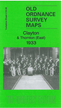
Yorkshire Sheet 216.06 Clayton & Thornton (East) 1933 - published 2012; intro by John Hargreaves. ISBN.978-1-84784-591-7 
This detailed map covers the centre of Clayton and the eastern part of Thornton.
Features include Thornton Hall, St James church, School Green, Leventhorp Hall, tramway, Clayton Beck, Leventhorp Mills, St John's church Clayton, Town End, Oak Mills, Victoria Park etc. On the reverse we include
a selection of street directory entries for 1936.
The map links up with sheet 216.07 Bradford West to the east and 216.10 Clayton Heights to the south.
You can order maps direct from our On-line Mapshop.
For other information and prices, and other areas, go to The Index Page.
Maps in the Godfrey Edition are taken from the 25 inch to the mile map and reduced to about 15 inches to the mile.
Follow this link for a complete list of our Bradford maps; or here for the
whole Yorkshire series.
Alan Godfrey Maps, Prospect Business Park, Leadgate, Consett, Co Durham, DH8 7PW / sales@alangodfreymaps.co.uk / 15 November 2017
 Here are the details of maps for Clayton (N):