We have published more than 2,000 maps in our series of Old Ordnance Survey Map reprints, including a major group for the Yorkshire area. The maps are highly detailed. They are taken from the OS 1:2,500 (or 25 inch) maps and reduced to about 15 inches to the mile. Each covers an area of a mile and a half by a mile. They show streets with individual houses, tram tracks, railway tracks and even signals, factories, wharves and such details as fountains and water troughs. They will provide hours of fascination for historians and genealogists. The maps are neatly folded and each includes a specially written introduction to the area. Maps can be purchased on our On-line Mapshop where further information about titles is given. Or visit The Index Page for a full list to the series and details of Prices.
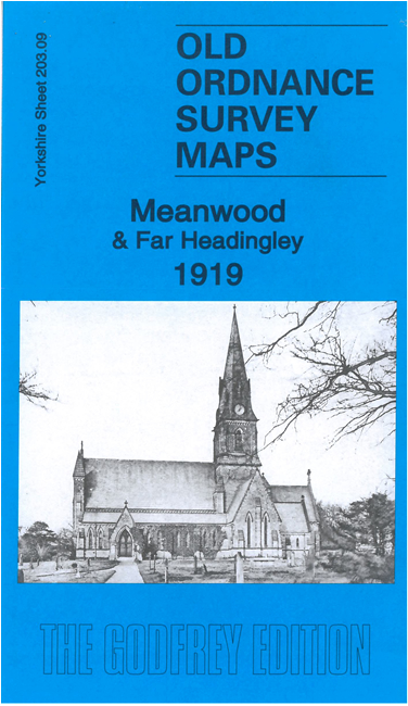
Here are the details of maps for Meanwood:
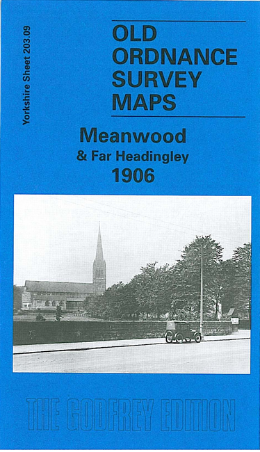
This detailed map covers the Meanwood area on the north side of Leeds. The northern part of Headingley, around St Chad's church, Otley Road and Moor Road, is in the bottom left corner and coverage extends north to Meanwood Hall, eastward to Carr Manor. The scattered communities across the map include Weetwood, Meanwood, Myrtle Square and Hill Top, Bentley. Features on what was still a semi-rural landscape include Holy Trinity church, Meanwood Tanneries, Weetwood Dye & Print Works, Bardon Hill, Bardon Grange, tramways terminating at Far Headingley and Bentley, Meanwood Quarry. Carr Manor and Meanwood Hall stand in extensive grounds. On the reverse we include a good selection of street directory entries for the area.
The map links up with Sheets 202.12 Horsforth Woodside to the west, 203.10 Chapel Allerton to the east, and 203.13 Headingley to the south.
Follow this link for a complete list of our Bradford and Leedsarea maps; or here for the whole Yorkshire series.
You can order maps direct from our On-line Mapshop. For other information and prices, and other areas, go to The Index Page.
Maps in the Godfrey Edition are taken from the 25 inch to the mile map and reduced to about 15 inches to the mile. For a full list of maps for England, return to the England page.
Alan Godfrey Maps, Prospect Business Park, Leadgate, Consett, Co Durham, DH8 7PW / godfreyedition@btinternet.com / 8 August 2007