Yorkshire Sheet 187.06 Otley 1906 - published 2004; intro by Suzanne Grahame. ISBN.978-1-84151-688-2 
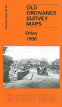
This detailed map covers the town of Otley, a few miles north of Leeds. The map covers most of the town and extends east to Russell Farm and Midgley Farm.
Features include the NER Otley Branch with station, All Saints church, Bondgate, Kirkgate, Boroughgate, Walkergate, Cross Green, Market Place, Gay Lane, Bridge Street,
Cattle Market, Manor House, Chevin Leather Works, Otley Bridge, Newall Hall (top left corner), Wharfeside, paper mill, Ashfield Foundry, Wharfedale Iron Works, cemetery etc. On
the reverse we include a commercial directory of Otley in 1889.
Follow this link for a complete list of our Bradford or Leeds area maps; or here for the
whole Yorkshire series. You can order maps direct from our On-line Mapshop.
For other information and prices, and other areas, go to The Index Page.
Most maps in the Godfrey Edition are taken from the 25 inch to the mile map and reduced to about 15 inches to the mile.
For a full list of maps for England, return to the England page.
Alan Godfrey Maps, Prospect Business Park, Leadgate, Consett, Co Durham, DH8 7PW / sales@alangodfreymaps.co.uk / 8th August 2017

 Here are the details of maps for Otley: