Old Ordnance Survey Maps of Yorkshire

  • These detailed maps normally cover an area of about one and a half miles by one mile. Each map includes an introduction.
  • They are available through our On-line Mapshop

  • Here are the details of maps for SE York:

  • Yorks Sheet 174.11 York (SE) & Heslington 1890 - published 2017; intro by Alan Godfrey. ISBN.978-1-78721-029-5

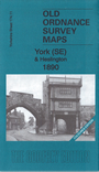
    This map is in colour, taken from the beautiful 1st Edition OS handcoloured map. It covers the area from Walmgate SE to Heslington.

    Features include: Walmgate Bar, St Margaret's church, City Wall, St Lawrence church, Convent of Poor Clares, Friend's Retreat, St Nicholas Hospital site, cattle market, Fulford Road with tramway, Cavalry Barracks, Infantry Barracks, Abbeyfield House, Heslington Hall, St Paul's church, Charles XII pub, Heslington Windmill etc. Extracts from a 1905 directory are included on the reverse.

    The map links up with Yorkshire Sheet 174.07 York NE to the north and 174.10 York South to the west.


  • You can order maps direct from our On-line Mapshop. For other information and prices, and other areas, go to The Index Page.
  • Maps in the Godfrey Edition are taken from the 25 inch to the mile map and reduced to about 15 inches to the mile. Follow this link for a complete list of our City of York maps; or here for the whole Yorkshire series.
    Alan Godfrey Maps, Prospect Business Park, Leadgate, Consett, Co Durham, DH8 7PW / sales@alangodfreymaps.co.uk / 17 January 2017