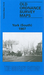
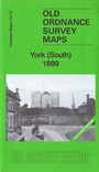
 Here are the details of maps for south York:


We have published two versions of this map, showing how the area changed across the years. The 1889 version is in colour, taken from the 1st Edition OS handcoloured edition.
These detailed maps cover the southern part of York. Coverage stretches from Micklegate southward to Campleshon Lane, and from Fawcetts Street westward to New Lane and Murray Street. Features on the map include the southern tip of the station and its railway approaches, including carriage works, engine shed, Holgate Junction (shown in detail with track layout), River Ouse, Nunthorpe Hall, Mount Vale, Holgate Road, South Bank, Nunthorpe Court, Blossom Street, City Wall, Nunnery Lane, Scarcroft Road, Skeldergate Bridge, York Castle, Court House, Clementhorpe, Bishopthorpe Road, Fishergate, glass works, River Foss Navigation with locks, Ebor Flour Mills, tramways. All is in great detail with individual houses clearly shown. We include extracts from early directories on the reverse.
The map links up with Yorkshire Sheet 174.06 City of York to the north and 174.11 York SE to the east.