
 Here are the details of maps for Malton & Norton:

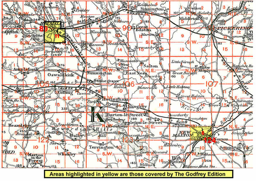
This map captures Malton in great detail, with individual houses neatly delineated. Three townships are shown: Old and New Malton, and the sister town of Norton on the other side of the Derwent. Malton is in the historic North Riding, Norton in the East Riding.
The town centre of Malton, ie New Malton, gets the most complete coverage on our map; features here include the Town Hall, St Michael's church, St Leonard's church, Yorkergate, Castlegate, Wheelgate, Newbiggin, Horse Market Road, Poor Law Institution. Coverage extends west along Castle Howard Road and Middlecave Road as far as Middlecave House. Old Malton Road extends NE past the site of the old Roman Fort to Old Malton, partly shown on the map; the church and Abbey House are at the margin. A section of the old Thirsk & Malton railway is shown with a siding to the quarry. South of the Derwent in Norton are the railway station, Commercial Street, Church Street, Wood Street, Wold Road, the map extending south as far as the cemetery. On the reverse we include lists of private residents for Malton and Norton from a 1905 directory.
And here is an index map showing the areas covered.