Yorkshire Sheet 110.11 Hunmanby 1926 - published 2005; intro by Susan Neave. ISBN.978-1-84151-735-3 
This map captures the small town of Hunmanby in detail and with its directory provides good historical coverage. Features on the map include the
railway with station, brick works, town centre, Hunmanby Hall, Parkhouse Farm, All Saints church, Bridlington Street,
Ratten Row, Stonegate, Northgate, Cross Hill, Hungate Lane, Low Hall, Harbour Hill. A directory of Hunmanby in 1905 is included on the reverse.
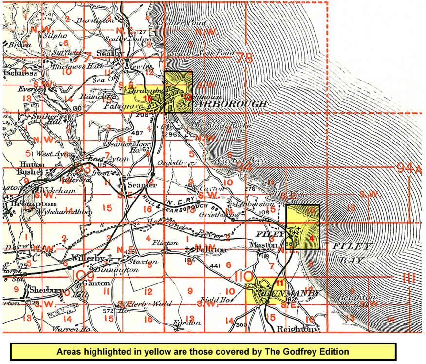
And here is an index map showing the area covered.
You can order maps direct from our On-line Mapshop.
For other information and prices, and other areas, go to The Index Page.
Maps in the Godfrey Edition are taken from the 25 inch to the mile map and reduced to about 15 inches to the mile.
Follow this link for a complete list of our North Yorkshire maps; or here for the
whole Yorkshire series.
Alan Godfrey Maps, Prospect Business Park, Leadgate, Consett, Co Durham, DH8 7PW /
sales@alangodfreymaps.co.uk / 25 January 2018

 Here are the details of maps for Hunmanby: