We have published more than 2,000 maps in our series of Old Ordnance Survey Map reprints, including a group in North Yorkshire. The maps are highly detailed. They are taken from the OS 1:2,500 (or 25 inch) maps and reduced to about 15 inches to the mile. Each covers an area of a mile and a half by a mile. They show streets with individual houses, tram tracks, railway tracks and even signals, factories, wharves and such details as fountains and water troughs. They will provide hours of fascination for historians and genealogists. The maps are neatly folded and each includes a specially written introduction to the area. Maps can be purchased on our On-line Mapshop where further information about titles is given. Or visit The Index Page for a full list to the series and details of Prices.
Here are the details of maps for Middleham & Redmire:
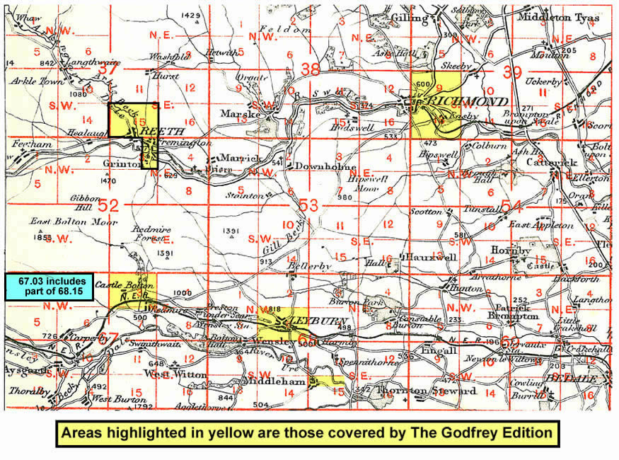
This detailed map is double-side to provide maximum coverage. The main map covers Castle Bolton, with the imposing Bolton Castle and St Oswald's church; coverage then extends eastward to Redmire where we include the village centre, including Town Hall, Hargill House, part of the station, King's Arms (but not the church). On the reverse we include a good part of sheet 68.15 which covers the tiny town of Middleham, with its great castle, Market Place, Town Hall, St Mary & St Alkelda's church, Middleham House, Neville Hall and William's Hill.
And here is an index map showing the areas covered.
Follow this link for a complete list of our North Yorkshire Series maps.
You can order maps direct from our On-line Mapshop. For other information and prices, and other areas, go to The Index Page.
Maps in the Godfrey Edition are taken from the 25 inch to the mile map and reduced to about 15 inches to the mile. For a full list of maps for the Yorkshire area, return to the Yorkshire page
The Godfrey Edition / godfreyedition@btinternet.com / 18 January 2008