We have published more than 2,000 maps in our series of Old Ordnance Survey Map reprints, including a group for the Yorkshire area. The maps are highly detailed. They are taken from the OS 1:2,500 (or 25 inch) maps and reduced to about 15 inches to the mile. Each covers an area of a mile and a half by a mile. They show streets with individual houses, tram tracks, railway tracks and even signals, factories, wharves and such details as fountains and water troughs. They will provide hours of fascination for historians and genealogists. The maps are neatly folded and each includes a specially written introduction to the area. Maps can be purchased on our On-line Mapshop where further information about titles is given. Or visit The Index Page for a full list to the series and details of Prices.
Here are the details of maps for Whitby:
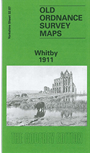
This highly detailed map covers Whitby, surely one of the most enjoyable seaside towns in the country. As expected, the map is crowded with the narrow streets and alleys that lead up from the harbour, each tiny house meticulously shown. The map covers virtually all the town and major features include (on the east bank) the great Abbey, St Mary's church, Abbey House, Workhouse, East Cliff, Church Street, Haggerlythe, Helredale, Whitehall Dockyard, Spital Vale, Collier Hope, Market Place. On the west bank are the railway and station, a stretch of the Saltburn & Whitby line with Prospect Hill Junction, Airy Hill, Fishburn Park, Victoria Square, Flowergate, Chubb Hill Road, Burtree Cragg, St Hilda's church, North Terrace, West Cliff, Boghall. Earlier on Whitby had been a great shipbuilding centre, had connections with Captain Cook, before going into decline in the 19th century. Today all visitors known the seemingly never-ending Church Stairs, depicted here, and the atmospheric scenes conjured up by Bram Stoker in Dracula. On the reverse of the map we include a list of private residents from a 1905 directory.
And here is an index map showing the areas covered.
Follow this link for a complete list of our North Yorkshire Series maps.
You can order maps direct from our On-line Mapshop. For other information and prices, and other areas, go to The Index Page.
Maps in the Godfrey Edition are taken from the 25 inch to the mile map and reduced to about 15 inches to the mile. For a full list of maps for Yorkshire, return to the Yorkshire page.
The Godfrey Edition / godfreyedition@btinternet.com / 12 May 2007