
 Here are the details of maps for Guisborough:

This detailed map of Guisborough is double-sided for maximum coverage. The main map covers the southern part of the town, incl the railway station, a good stretch of the railway including Hutton Junction, and the mineral railway to Belmont ironstone mine. Other features are West Street, Belmangate, hospital, Brow Hill, Chapel Beck Bridge. On the reverse we have a good section of adjacent map 17.07, extending coverage north and including most of the town centre. Features here are St Nicholas church, the Priory remains, West Street, Market Place, Poor Law Institution, Bolckow Street.
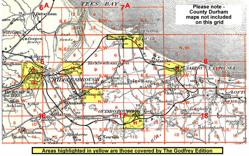
And here is an index map showing the areas covered.