We have published more than 2,000 maps in our series of Old Ordnance Survey Map reprints, including a group for the Yorkshire area. The maps are highly detailed. They are taken from the OS 1:2,500 (or 25 inch) maps and reduced to about 15 inches to the mile. Each covers an area of a mile and a half by a mile. They show streets with individual houses, tram tracks, railway tracks and even signals, factories, wharves and such details as fountains and water troughs. They will provide hours of fascination for historians and genealogists. The maps are neatly folded and each includes a specially written introduction to the area. Maps can be purchased on our On-line Mapshop where further information about titles is given. Or visit The Index Page for a full list to the series and details of Prices.
Here are the details of maps for Saltburn:
This detailed map captures the delightful resort of Saltburn, one of the most perfect of 'Victorian' seaside towns. Most of the town is covered and features include the railway with station, engine shed and Saltburn Extension Junction; Pier, incline tramway, Zetland Hotel (with its own railway platform), Britannia Terrace, Assembly Hall, Saltburn Bridge, Emmanuel church, Brine Baths, Marine Terrace, Convalescent Home, Skelton Beck, White House Wood, Old Saltburn, cemetery, Windy Hill. On the reverse we include a 1904 directory of Saltburn.
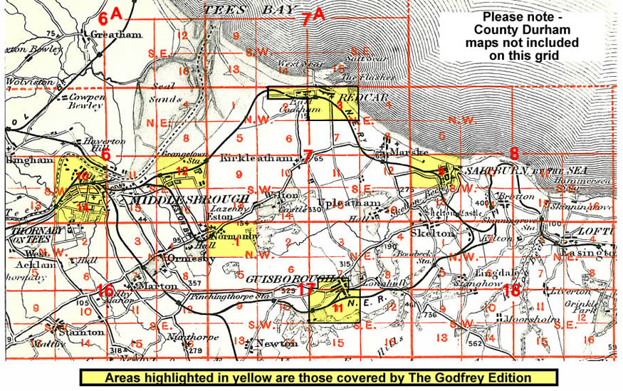
And here is an index map showing the areas covered.
Follow this link for a complete list of our Cleveland or North Yorkshire maps; or here for the whole Yorkshire series.
You can order maps direct from our On-line Mapshop. For other information and prices, and other areas, go to The Index Page.
Maps in the Godfrey Edition are taken from the 25 inch to the mile map and reduced to about 15 inches to the mile. For a full list of maps for England, return to the England page.
The Godfrey Edition / godfreyedition@btinternet.com / 14 May 2007