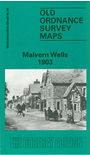
 Here are the details of maps for Malvern Wells:

This detailed map is double-sided for maximum coverage.
The main map covers the area from the Wyche Cutting southward to Green Lane, and from Hanley Road westward across the Hills to Colwall station. Features include (on the Malvern side) St Peter's church, Hornyold Arms Hotel, Holy Well, The Wells House, The Cottage, Essington Hotel, Hornyold Wood, Wood Farm, etc. A good section of the Malvern Hills is shown and across it (on the Herefordshire side) are Broadfields, Linden, Knell New House, Upper Wyche, Knell Farm, Winnings Farm, Redland Lodge, Colwall Stone, railway with Colwall station and both entrances to tunnel shown, Vinegar Works, New Court, The Gables, part of race course.
On the reverse we include part of adjacent sheet 46.08 extending coverage south to include St Wulstan's RC Chapel in Little Malvern, Graham House, The Abbey etc.
The map links up with Worcs sheet 39.16 Malvern: Wyche to the north.