
 Here are the details of maps for Worcester (SW):

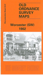
This detailed map covers the SW quarter of Worcester, with coverage stretching from St Andrew's church westward to Laughern Brook, and from The Butt southward to Boughton Park. The map is dominated by the St John's area.
Features include River Severn, Worcester Bridge, tramway, County Cricket Ground, stretch of GWR railway with Henwick station, St John's cemetery, St John's church, Vernon Park, Pitmaston House, Bromwich Farm, Bridge Mills, Royal Albert Orphan Asylum, St John's Nurseries, cattle market, Butts Siding etc. On the reverse we include a selection of street directory entries, incl Bransford Road, Bridge Street, Broad Street, Bromyard Road, The Butts, Henwick Road, McIntyre Road, St John's, Tybridge Street; plus a timetable for the Worcester-Leominster line.
The map links up with sheets 33.03 Worcester NW to the north and 33.08 Worcester SE to the east.