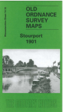
 Here are the details of maps for Stourport:

This detailed map of Stourport is double-sided for maximum coverage.
The main map covers the centre and north of the town, with coverage extending north of the railway to include the Newtown area and part of Upper Mitton. Features include railway with station, Staffordshire & Worcestershire Canal, Bullocklane Bridge, Upper Milton Bridge, Mitton Gardens, enamel works, carpet mill, St Michael's church, iron foundry, Moor Hall, Lickhill Lodge, corn mill, tin works, tramway, etc.
On the reverse we include part of adjacent sheet 14.14, extending coverage southward to include River Severn with basins, vinegar works, Severn Valley Works, Tontine Buildings, dry dock, Areley Kings, St Bartholomew's church, Areley Court, Areley House, Walshe's Farm.