 Here are the details of maps for Kidderminster:

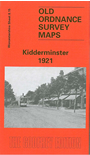
This detailed map covers most of the town of Kidderminster. Coverage stretches from Proud Cross and Sutton Road eastward to Chaddesley Road, and from Imperial Avenue southward to Holman Street.
This is a busy map and the many features include GWR railway with station, numerous carpet works, Workhouse (at left margin of map), Stourvale Mill, Long Meadow Mills, Slingfield Spinning Mill, Park Wharf Mills, St John the Baptist church, Infirmary, Staffordshire & Worcestershire Canal, tramways, Constitution Hill area, Cemetery, St George's church, High Street and town centre, brewery, Holy Trinity Convent, Axminster Works, St Mary & All Saints church, King Charles I Grammar School, Larkhill area, cattle market etc. On the reverse we include a list of private residents from an 1896 directory.