
 Here are details of maps for Wilton:
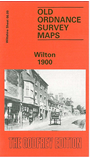
Wiltshire Sheet 66.09 Wilton 1900 - published 1994; intro by Alan Godfrey. ISBN.978-0-85054-693-4 
This detailed map of Wilton is double-sided for maximum coverage.
The main map covers the centre of the town and extends south to cover much of Wilton Park, and westward to Ugford Farm. Features include Wilton House, Bulbridge Farm, Washern Grange, St Peter's church at Fugglestone St Peter, St Mary & St Nicholas church, Cross Bridge, Kingsbury Square, Bulbridge House, Market Place, Town Hall, carpet factory.
On the reverse we include a good section of adjacent sheet 66.05 extending coverage northward to include Burden's Ball, Wilton Workhouse, both railway stations, Ditchampton Farm, with coverage extending northward to Chilhampton Farm.