
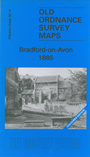
 These are our maps for Bradford-on-Avon:


We have published two versions of this map of Bradford-on-Avon, showing how the area changed across the years. The 1885 version is in colour, taken from the beautiful 1st Edition handcoloured OS map.
Most of the town is covered, with coverage extending from eastward to Woolley Terrace, southward to the Kennet & Avon Canal, northward to Berryfield House. Features include railway with station, River Avon, canal, Christ Church, Holy Trinity church, Greenland Mills, Middle Mill, Kingston Mills, Woollen Mills, Dye Works, The Priory, The Chantry, New Mills, The Hall, Bearfield area, Lower Bearfield Farm, Belcombe Place, Barton Farm, Budbury House, Belcombe House, Upper Bearfield etc. On the reverse we include extracts from early directories.