Old Ordnance Survey Maps of Calne


We have published more than 2,000 maps in our series of Old Ordnance Survey Map reprints, including a group for the Wiltshire area. The maps are highly detailed. They are taken from the OS 1:2,500 (or 25 inch) maps and reduced to about 15 inches to the mile. Each covers an area of a mile and a half by a mile. They show streets with individual houses, tram tracks, railway tracks and even signals, factories, wharves and such details as fountains and water troughs. They will provide hours of fascination for historians and genealogists. The maps are neatly folded and each includes a specially written introduction to the area. Maps can be purchased on our On-line Mapshop where further information about titles is given. Or visit The Index Page for a full list to the series and details of Prices.


Here are the details of maps for Calne:

  • Wiltshire Sheet 27.05 Calne 1899 - published 1996; introduction by Alan Godfrey.

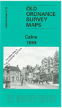
    The map the small town of Calne in great detail. This became a borough in 1086 and was a prosperpous cloth town in the middle ages, but by the 1890s it was better known for bacon. The town had its own railway branch, shown here with station and Black Dog Siding, and other features include The Strand, workhouse, bacon factory, St Mary's church, etc. To the west of Calne, vast areas of fields dominate the landscape, which the River Marden and the Wilts & Berks Canal cut through on their way to the heart of the town. Along with Kingsbury Green, all the schools, hospitals, allotments and the town centre are marked on to give you a true impression of what the town felt like in 1899. To compliment the map we include a brief history of Calne, covering the Manor Houses and transport history. You can also find a commercial directory and the Calne Branch train timetable printed on the reverse of the map.


    Follow this link for a complete list of our Wiltshire Series maps.

    You can order maps direct from our On-line Mapshop. For other information and prices, and other areas, go to The Index Page.


    Maps in the Godfrey Edition are taken from the 25 inch to the mile map and reduced to about 15 inches to the mile. For a full list of maps for England, return to the England page.

    The Godfrey Edition / godfreyedition@btinternet.com / 29 Oct 2006