Old Ordnance Survey Maps of London

  • These detailed maps maps normally cover an area of about one and a half miles by one mile. Each map includes an introduction. The London maps link up with those for Middlesex to form a major series for the Greater London area. They are available through our On-line Mapshop

  • Here are the details of maps for the Isle of Dogs:

  • London Sheet 79.1 West India Docks 1867 - published 1991; intro by Oliver Harris. ISBN.978-0-85054-466-4
  • London Sheet 79.2 West India Docks & Greenwich Marshes 1894 - published 2000; intro by Alan Godfrey. ISBN.978-1-84151-194-8
  • London Sheet 79.3 West India Docks 1914 - published 1991; intro by David Mander. ISBN.978-0-85054-444-2

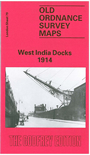
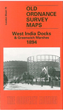
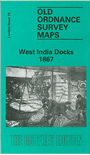
    We have published three versions of this map, showing how the area developed across the years. The sheetlines are a little unkind to the Isle of Dogs, which is split between several sheets (78, 79, 91, 92) but this is perhaps the main map for that area. These three maps all cover the same area, stretching from Poplar Docks southward to the north part of Cubitt Town, and including major parts of the two West India Docks, the South Dock and Millwall Inner Dock. Part of Millwall Outer Dock is at the extreme foot of the map. Blackwall with its shipbuilding yards is at the top of the map. Across the Thames are Greenwich Marshes, growing more developed over the years and today, of course, famous for the Dome. The maps provide interesting contrasts, so here are a few words about each:


  • The 1867 map shows Cubitt Town developed by the river, and all the docks built. London & Blackwall Railway is at the top, with Poplar station at the margin; LNER Goods station shown. Features include Blackwall Yard and shipbuilding yard. Greenwich Marshes still largely undeveloped except for electric telelgraph works and 'Iron Boat Building Yard'. Several shipbuilding yards on east side of Isle of Dogs. On reverse we include a list of shipbuilders and related trades from an 1859 directory.
  • The 1894 map shows the area more developed. The Timber Dock on the earlier map is now the South Dock and the railway extends south through Isle of Dogs, the Millwall Extension, with Millwall Junction, South Dock, Millwall Dock stations and many sidings and depots. On Greenwich Marshes there is more development, now with Ordnance Wharf, gas works etc. Street directory extracts on reverse, plus a railway timetable for the Fenchurch St to Blackwall and North Greenwich railway.
  • Development continues on the 1914 map, now densely built up; on Greenwiches Marshes the South Metropolitan Gas Co now sprawls across vast area, with many railway sidings. Blackwall Tunnel now shown. Along with the other maps, the fine amount of detail - railway tracks, wharves, mooring posts, cranes etc - helps provide a fascinating contrast with the Docklands of today.

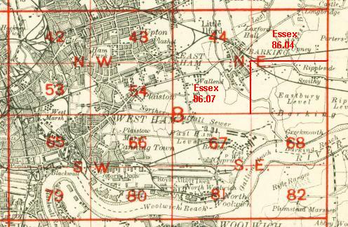
    The map links up with London Sheets 65 Poplar to the north, 78 Rotherhithe to the west, 80 Silvertown to the east, 92 Greenwich to the south.


  • Follow this link for a complete list of our London maps .
  • You can order maps direct from our On-line Mapshop. For other information and prices, and other areas, go to The Index Page.
  • Maps in the Godfrey Edition are taken from the 25 inch to the mile map and reduced to about 15 inches to the mile. For a full list of maps for England, return to the England page.
    Alan Godfrey Maps, Prospect Business Park, Leadgate, Consett, Co Durham, DH8 7PW / sales@alangodfreymaps.co.uk / 18 February 2018