
 Here are the details of maps for Welsh Harp:

We have published two versions of this map, nshowing how it developed across the years. They provide a great contrast, for much of the 1895 version is rural, but by 1936 the western and eastern areas are increasingly built up.
The map is centred on Brent Reservoir, and coverage stretches from Holden Avenue and Church Lane eastward to Sturgess Avenue; and from Borthwick Road and Fryent Grove southward to Review Road and the North Circular.
Features include the Old Welsh Harp pub. The reservoir was opened in 1838 and subsequently enlarged; during the 19th century thousands flocked here, drawn by the pleasure gardens at the Old Welsh Harp and Upper Welsh Harp inns. Welsh Harp station opened to serve these customers in 1870, but closed in 1903 when trade declined and the area was developed. The Old Welsh Harp inn was demolished in 1971 to make way for the Staples Corner flyover. On the reverse of the 1895 map we include a contemporary description, with illustrations, of the Welsh Harp pleasure gardens. The 1936 map includes some extracts from a contemporary street directory.
The map links up with Middlesex Sheet 11.06 Kingsbury Green to the north, 11.09 Preston Road to the west, London Sheets 17 Golders Green to the east and 25 Neasden to the south.
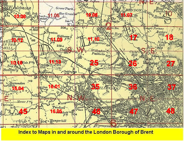 Follow this link for a list of our maps for the London Borough of Brent, or here for a complete list of our London maps .