Old Ordnance Survey Maps of Warwickshire

  • These detailed maps normally cover an area of about one and a half miles by one mile. Each map includes an introduction.
  • They are available through our On-line Mapshop

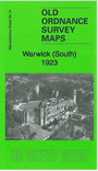
  • Here are the details of maps for Warwick (South):

  • Warwickshire Sheet 33.14 Warwick (South) 1923 - published 2013; intro by Barrie Trinder. ISBN.978-1-84784-687-7

    This detailed map covers the southern part of Warwick, with coverage stretching from the Castle eastward to Henry VIII Farm, and from Priory Road southward to Temple Hill.

    Features include Warwick Castle, King's School, Myton Grange, Myton Crescent, Bridge End area, River Avon, St Nicholas church, St Mary's church (split by east margin), St Nicholas Meadow, East Gate, Smith Street, part of High Street etc. A section of a 1921 directory is included on the reverse.

    The map links up with sheets 33.15 Leamington South to the east and 33.11 Warwick North to the north.


  • For a full list of maps of Warwickshire, please go to the Warwickshire or Birmingham pages.
  • You can order maps direct from our On-line Mapshop. For other information and prices, and other areas, go to The Index Page.
  • Maps in the Godfrey Edition are taken from the 25 inch to the mile map and reduced to about 15 inches to the mile.
  • For a full list of maps for England, return to the England page.
    Alan Godfrey Maps, Prospect Business Park, Leadgate, Consett, Co Durham, DH8 7PW / sales@alangodfreymaps.co.uk / 23 November 2017