
 Here are the details of maps for Harborne (S):

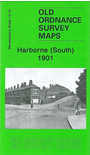
The map also includes Worcestershire sheet 5.15. This detailed map covers the southern part of Harborne and northern fringe of Northfield. Coverage stretches from Victoria Road southward to Weoley Park Farm and the northern tip of Selly Oak Park; and from Metchley Lane westward to Barnes Hill.
Features include St Peter's church, Harborne Hall, Mill Farm, Dudley Canal, California area, site of Weoley Castle, Metchley Grange, The Grove, Harborne House, Gravel Bank, Welsh House Farm etc. On the reverse we include street directory entries for Harborne Lane, Metchley Lane, Northfield Road, Old Church Road, St Mary's Road, St Peter's Road and Victoria Road.
The map links up with sheets 13.11 Harborne to the north and 13.16 Bournbrook to the east; and Worcestershire sheet 10.03 Griffins Hill to the south.