Old Ordnance Survey Maps of Warwickshire

  • These detailed maps normally cover an area of about one and a half miles by one mile. Each map includes an introduction.
  • They are available through our On-line Mapshop

  • Here are the details of maps for Attleborough:

  • Warwickshire Sheet 11.13 Chilvers Cotton & Attleborough 1902 - published 2002; intro by John Gough. ISBN.978-1-84151-412-3

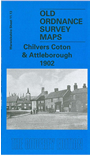
    This detailed map covers the villages of Chilvers Coton and Attleborough, just south of Nuneaton. Features at Chilvers Coton include All Saints church, Nuneaton Workhouse, LNWR railway with Chilvers Coton station, Chilvers Coton Foundry, Coventry Canal, Old Wharf Inn etc. At Attleborough features include Holy Trinity church, Caldwell, Elastic Web Works, Attleborough Hall, cemetery, southern part of Attleborough Mills. The map extends southward to the Griff Arm of Coventry Canal, and Bermuda, including Griff Colliery Pumping Works, various mineral tramways, LNWR Griff Branch, Old Homestead. We include 1921 directories for both Attleborough and Chilvers Coton on the reverse.

    The map links up with sheet 11.09 Nuneaton to the north


  • For a full list of maps of Warwickshire, please go to the Warwickshire or Birmingham pages.
  • You can order maps direct from our On-line Mapshop. For other information and prices, and other areas, go to The Index Page.
  • Maps in the Godfrey Edition are taken from the 25 inch to the mile map and reduced to about 15 inches to the mile.
  • For a full list of maps for England, return to the England page.
    Alan Godfrey Maps, Prospect Business Park, Leadgate, Consett, Co Durham, DH8 7PW / sales@alangodfreymaps.co.uk / 23 November 2017