 Here are the details of maps for Nuneaton:

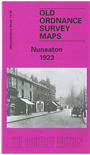
This detailed map covers most of Nuneaton, with coverage stretching from Earls Road eastward to Hinckley Road, and from Jodrell Street and Stoney Road southward to William Street. This is a busy map and the many features include railway with station, Abbey station, engine shed, junctions, sidings, most of flyover line; Attleborough Mills, Anker Mill, Nuneaton Wool Works, Market Place and town centre with all individual buildings shown, St Nicholas church, Newdegate Dye Works, St Mary's Abbey, stretches of Coventry Canal, Riversley Park, Abbey Green area, silk manufactory, King Edward VI Grammar School, The Mills, River Anker, etc. On the reverse we include a list of private residents from a 1921 directory.
The map links up with sheet 11.13 Chilvers Coton to the south.