
 Here are the details of maps for Wandsworth:

We have published two versions of this detailed map, showing how Wandsworth changed over the years. Each covers an area of a mile by a mile and a half, running from Red Lion Street and the River Wandle eastward to Leathwaite Road, and from St John's Hill and Clapham Junction station southward to Dorlcote Road.
Features on the map include the southern part of Clapham Junction station, Wandsworth station, brewery, mill and canal near the River Wandle, Royal Paper Mills, part of Wandsworth Common, Royal Victoria Patriotic Asylum, St Peter's Hospital, New Wandsworth goods station, Wandsworth & Clapham Union Infirmary, tramways, St Mary's Cemetery. Churches include St Anne's, St Paul's, St Mark's Battersea Rise. Streets include Bolingbroke Grove, part of Lavender Hill, St John's Hill, East Hill, North Street, South Street and many more. Each map includes extracts from a contemporary directory
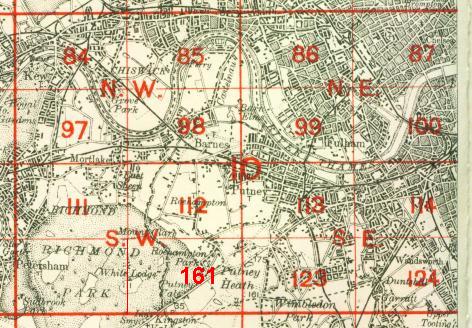
The map links up with Sheets 100 Battersea & Fulham to the north, 113 Putney to the west, 115 Clapham Common to the east, 124 Wandsworth Common to the south.
 Follow this link for a complete list of our London maps .