
 Here are the details of maps for Tonbridge:

This detailed map shows the town of Tonbridge, broadly running north-south in the western half of the map, with countryside stretching eastward as far as the hamlet of Postern Heath. Coverage stretches from Tonbridge School southward to Quarry Hill Road and Pembury Road. Principal features include the castle, a surprisingly dominant feature on the map; the railway station with engine shed and junctions; Great Bridge, Medway Wharf, St Peter & St Paul's church, St Stephens church, Agricultural Hall, Hectorage, Walter's Farm, Tonbridge School, Priory Road, High Street, Hadlow Road. The River Medway meanders across the map and numerous rivulets are seen running into it. On the reverse is an extract from Kelly's Directory of 1905, listing the private residents.
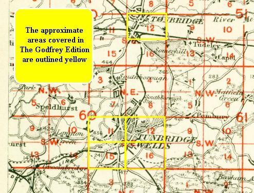
An index map showing the area covered by the map is available here.