We have published more than 1,900 maps in our series of Old Ordnance Survey Map reprints, including groups in Hampshire and Wiltshire. The maps are highly detailed. They are taken from the OS 1:2,500 (or 25 inch) maps and reduced to about 15 inches to the mile. Each covers an area of a mile and a half by a mile. They show streets with individual houses, tram tracks, railway tracks and even signals, factories, wharves and such details as fountains and water troughs. They will provide hours of fascination for historians and genealogists. The maps are neatly folded and each includes a specially written introduction to the area. Maps can be purchased on our On-line Mapshop where further information about titles is given. Or visit The Index Page for a full list to the series and details of Prices.
Here are the details of maps for Tidworth:
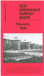
This very detailed map crosses the Wilts/Hants border and is also Wiltshire Sheet 48.15. It will be of unusual interest to family historians, for countless hundreds of relatives will have lived here briefly while on military service. Our map is double-sided to provide maximum coverage. The main map covers the area from North Tidworth and North Manor House southward to South Tidworth and Ashdown House. Features include much of Tidworth Barracks, including Bhurtpore Barracks, Candahar Barracks, Delhi Military Hospital, Jellalabad Barracks, Isolation Hospital, St Michael's church, Hampshire Cross, Lucknow Barracks, Mooltan Barracks, Clarendon Hill, rifle ranges, riding school, officers messes, station, military railway running through the barracks and sidings into an unnamed (ammunition?) depot, Holy Trinity church. On the reverse we include part of sheet 23.03 and this extends coverage south to include Tidworth (or Tedworth) House and part of Tidworth Park. Tony Painter provides a lucid history of Tidworth, through the growth of the Tidworth Estate to the continuing development of today's major military complex.
Follow this link for a complete list of our Hampshire or Wiltshire Series maps.
You can order maps direct from our On-line Mapshop. For other information and prices, and other areas, go to The Index Page.
Maps in the Godfrey Edition are taken from the 25 inch to the mile map and reduced to about 15 inches to the mile. For a full list of maps for the South West, return to the South West page.
The Godfrey Edition / godfreyedition@btinternet.com / 3 February 2006