
 Here are the details of maps for Thaxted:

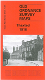
This detailed map shows the small town of Thaxted. The town centre is at the top of the main map, including the church, Town Street, Newbiggin Street, and coverage extends about half a mile to the east, and a mile south. The terminus of the Elsenham & Thaxted Railway is also on the map. On the reverse we include a little of adjoining sheet 14.15, showing the north of the town. Outside the town the map is very rural. We also include a commercial directory from 1895, and a timetable for the Thaxted-Elsenham railway in 1915.
Maps in the Godfrey Edition are taken from the 25 inch to the mile map and reduced to about 15 inches to the mile. For a full list of maps for England, return to the England page.
Alan Godfrey Maps, Prospect Business Park, Leadgate, Consett, Co Durham, DH8 7PW / sales@alangodfreymaps.co.uk / 25 November 2017