Old Ordnance Survey Maps of Surrey

  • These detailed maps normally cover an area of about one and a half miles by one mile. Each map includes an introduction.
  • They are available through our On-line Mapshop

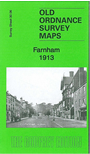
  • Here are the details of the map for Farnham:

  • Surrey Sheet 30.06 Farnham 1913 - published 2014; intro by Alan Godfrey. ISBN.978-1-84784-846-8

    This detailed map of Farnham is double-sided for maximum coverage.

    The main map covers the centre of the town with coverage southward to Searle Road and Cromwell Avenue. Features include railway with station, St Andrew's church, Fir Grove, Vernon House, Weydonhill Farm, Fairfield area, Town Hall, Castle, Emmanuel church, malthouses, Waverley Estate, Culverlands, Hatch Mill, Windsor almshouses, St James's church, schools, banks, etc.

    On the reverse we include an extract from adjacent sheet 30.02, extending overage northward to include Farnham Park, workhouse, Bourne Mill.


    For a limited period the introductory notes to this map are online here.
  • Follow this link for a complete list of our Surrey maps, here for Croydon, or here for the London Boroughs.
  • You can order maps direct from our On-line Mapshop. For other information and Prices, see Index Page.
  • Most maps in the Godfrey Edition are taken from the 25 inch to the mile map and reduced to about 15 inches to the mile.
    The Godfrey Edition / sales@alangodfreymaps.co.uk / 12 January 2018