
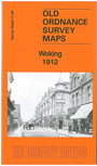
 Here are the details of the map for Woking:

This detailed map of Woking is double-sided for maximum coverage.
The main map covers the centre of the town with coverage southward to Hoe Bridge. Features include railway with station, turntable, Christ Church, eastern part of Mount Hermon, St Dunstan's RC church, many detached villas south of the railway, Hoe Place, Monument Hill, St Peter's Home, Maybury Inn, etc.
On the reverse we include a large extract of adjacent map 17.05, extending coverage to include Mosque, Oriental Institute, LSWR Orphanage, gas works, Basingstoke Canal, Monument Bridge, Mayhurst, Wheatsheaf Bridge, Alwyne House, northern part of town centre.