Old Ordnance Survey Maps of Cheam (West)


We have published more than 2,500 maps in our series of Old Ordnance Survey Map reprints, some 500 of them in the London area. The maps are highly detailed. They are taken from the OS 1:2,500 (or 25 inch) maps and reduced to about 15 inches to the mile. They show streets with individual houses, tram tracks, railway tracks and even signals, factories, wharves and such details as fountains and water troughs. They will provide hours of fascination for historians and genealogists. The maps are neatly folded and each includes a specially written introduction to the area. Maps can be purchased on our On-line Mapshop where further information about titles is given. For other information and Prices, see Index Page.


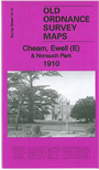
Here are the details of maps for Cheam (West):

  • Surrey Sheet 13.14 Cheam, Ewell (E) & Nonsuch Park 1910 - published 2012; intro by Richard Oliver. ISBN.978-1-84784-580-1

    This detailed map covers the western part of Cheam and extends west to Ewell. Nonsuch Park is central to the map.

    Feratures include Nonsuch Park, St Dunstan's church Cheam, Cheam House, Cheam Park, Harefield House, stretch of railway but no stations, site of Nonsuch Palace, St Mary's church Ewell, Nonsuch Pottery, Spring Hotel, portion of Ewell High St (in bottom left corner), Warren Farm. On the reverse we include a 1903 directory of Cheam.

    The map links up with Surrey Sheets 13.13 Ewell West to the west, 13.15 Sutton to the east.


    Follow this link for a complete list of our Surrey maps or our London Series.

    You can order maps direct from our On-line Mapshop. For other information and Prices, see Index Page.


    Maps in the Godfrey Edition are taken from the 25 inch to the mile map and reduced to about 15 inches to the mile. For a full list of maps for London, return to the London page.

    The Godfrey Edition / godfreyedition@btinternet.com / 14 Dec 2012