Old Ordnance Survey Maps of Surrey

  • These detailed maps normally cover an area of about one and a half miles by one mile. Each map includes an introduction.
  • They are available through our On-line Mapshop

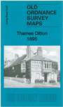
  • Here are the details of the map for Thames Ditton:

  • Surrey Sheet 12.07 Thames Ditton 1895 - published 2011; intro by Alan Godfrey. ISBN.978-1-84784-515-3

    This detailed map covers Thames Ditton, part of Long Ditton, and Weston Green. Coverage stretches from St Nicholas church to Esher station.

    Features include Thames Ditton village, Swan Inn, Ditton House, Boyle Farm, Giggshill, Rushett; railway with Hampton Court Junction, Esher and Thames Ditton stations; Ember or Imber Court, Weston Green, Ditton Common, Weston House etc. Extracts from a contemporary directory are included on the reverse.

    The map links up with Surrey sheet 12.03 Hampton Court to the north and 12.08 Surbiton to the east.


  • Follow this link for a complete list of our Surrey maps, here for Croydon, or here for the London Boroughs.
  • You can order maps direct from our On-line Mapshop. For other information and Prices, see Index Page.
  • Most maps in the Godfrey Edition are taken from the 25 inch to the mile map and reduced to about 15 inches to the mile.
    The Godfrey Edition / sales@alangodfreymaps.co.uk / 12 January 2018