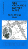
Staffordshire Sheet 68.03 Tame Bridge 1901 - published 2009; intro by Malcolm Nixon. ISBN.978-1-84784-284-8 
This detailed map covers a largely rural area east of Wednesbury and north of West Bromwich. Tame Bridge is in the top left corner, Grove Vale in the bottom right corner.
Features include the Tame Valley Canal, Rushall Canal, LNWR Grand Junction Line, Ray Hall, Charlemont Hall.
The map links up with Staffordshire sheets 63.15 Delves to the north, 68.02 Wednesbury Mesty Croft to the west, 68.04 Great Barr to the east.
For a full list of maps of Sandwell and Dudley go to the Sandwell and Dudley pages,
or to the West Midlands page for all maps of the area.
You can order maps direct from our On-line Mapshop.
For other information and prices, and other areas, go to The Index Page.
Maps in the Godfrey Edition are taken from the 25 inch to the mile map and reduced to about 15 inches to the mile.
For a full list of maps for England, return to the England page.
Alan Godfrey Maps, Prospect Business Park, Leadgate, Consett, Co Durham, DH8 7PW / sales@alangodfreymaps.co.uk / 13 January 2018
 Here are the details of maps for Tame Bridge: