Old Ordnance Survey Maps of Wolverhampton

  • These detailed maps normally cover an area of about one and a half miles by one mile. Each map includes an introduction.
  • They are available through our On-line Mapshop

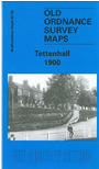
  • Here are details of the map for Tettenhall:

  • Staffordshire Sheet 62.05 Tettenhall 1900 - published 2005; intro by Angus Dunphy. ISBN.978-1-84151-771-1

    This detailed map covers most of Tettenhall, including Tettenhall Wood, west of Wolverhampton. Coverage extends from Tettenhall Upper Green southward to Compton Hall.

    Features include Tettenhall Wood House, Christ Church, Compton Hill, Elmsdale Hall, Dippons Farm, Long Lake, Tettenhall Towers, Tettenhall College, Manor House, Lower Green, Upper Green, Gorsty Hayes Manor House, Staffordshire & Worcestershire Canal, Compton. On the reverse we include 1912 directories of Tettenhall, Compton and Tettenhall Wood.

    The map links up with Staffordshire sheets 62.06 Wolverhampton NW to the east, 62.09 Finchfield to the south.


  • Follow this link for a complete list of our Wolverhampton maps; or here for the whole West Midlands series.
  • You can order maps direct from our On-line Mapshop. For other information and prices, and other areas, go to The Index Page.
  • Maps in the Godfrey Edition are taken from the 25 inch to the mile map and reduced to about 15 inches to the mile. For a full list of maps for England, return to the England page.
    Alan Godfrey Maps, Prospect Business Park, Leadgate, Consett, Co Durham, DH8 7PW / sales@alangodfreymaps.co.uk / 27 July 2017