
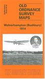
 Here are details of the map for Bushbury:

This detailed map covers the Bushbury and Dunstall Park area, on the north side of Wolverhampton. Coverage extends from Dunstall Park station northward to Oxley Manor, and from Shaw Road westward to Lower Street at Tettenhall.
Features include Dunstall Park Racecourse, stretch of GWR railway with Dunstall Park station, Oxley Sidings, engine shed, Wulfruna's Well, Dunstall House, tramways, Bushbury Lane, Oxley Manor, Aldersley, Clare House. Railway to Kingswinford is shown as 'under construction'. We include directories of Bushbury for 1912 and 1925 on the reverse.
The map links up with Staffordshire sheets 62.06 Wolverhampton NW to the south.