
 Here are the details of maps for Cannock (South):

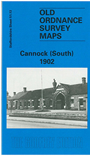
This detailed map of south Cannock is double-sided for maximum coverage.
The main map, sheet 51.13, covers the southern part of the town, with coverage extending southward to Bridgtown. Features include LNWR Cannock Branch with Cannock station, Leacroft Buildings, schools, Cannock Union Workhouse, Hallcourt Villas, stretch of Watling Street, Churchbridge Branch Canal, Longford House, Wedge's Mill, Longhouse Brick Works, District Edge Tool Works, Cannock Edge Tool Works, Walk Mill Tileries, St Paul's church Bridgtown.
On the reverse we include a large section of adjacent map 51.14 which extends coverage eastward about half a mile. Features here include Cannock Extension Canal, Churchbridge Locks, Cannock & Leacroft Colliery, Rumer Hill, Mill GFreen, Leacroft Wharf.
The map links up with Staffordshire sheet 51.10 Cannock North to the north.