
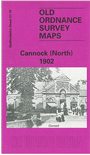
 Here are the details of maps for Cannock (North):

This detailed map of north Cannock is double-sided for maximum coverage.
The main map, sheet 51.10, covers the area east of the town, with much of railway and canal interest. Features here include East Cannock Colliery, Cannock Chase Colliery, The Mount, Cannock Extension Canal with Hednesford Basin Wharf, Hemlock's Farm, Sidon Hill, Milking Bank, stretch of LNWR Cannock Branch to East Cannock Junction, stretch of LNWR Norton Branch, LNWR Littleworth Extension Branch.
On the reverse we include a large section of adjacent map 51.09 which extends coverage westward to the town of Cannock. Features here include brewery, Market Place, St Luke's church, Market Hall, Stafford Road area, Oldfallow, Stony Lea, Blackfords, Broomhill Bank, Cannock Cemetery, Oldfallow House (at top of map).
The map links up with Staffordshire sheet 51.13 Cannock South to the south.