
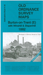
 Here are the details of maps for Burton (East):


This map is double-sided for maximum coverage. It covers the eastern part of Burton and continues across the River Trent into Derbyshire, where it includes the villages of Winshill and Stapenhill.
The main map is sheet 41.09 (Derbyshire 57.09) and is colour printed, taken from the beautiful handcoloured OS 1st Edition. Coverage extends from Wetmoor southward to Bridge Street and eastward to Winshill. Features include the River Trent, several breweries and malthouses, the Wetmoor Road area, Bridge Brewery, Forge Mill, St Mark's church Winshill, Bladonhouse Farm etc.
On the reverse we include part of adjacent sheet 41.13 which extends coverage southward. This map (which is not coloured) includes the Old Brewery, Stapenhill village, Stapenhill House, St Peter's church, Scalpcliff Hill etc.
The map links up with Staffordshire sheets 40.12 Burton North and 40.16 Burton South to the west.