
 Here are the details of maps for Burton (South):


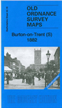
We have published two versions of this detailed map, showing how the area developed across the years. The 1882 version is colour printed, taken from the beautiful 1st Edition handcoloured map. The maps cover the southern part of the town, with coverage extending from the railway station southward to Varlow Street, and from High Street westward to Bean's Covert and Ordish's Farm.
The many features include Midland Railway with sidings and lines into breweries, engine shed, Branston Curve, Birmingham Curve Junction, Duke Street Branch, Bond End & Shobnall Branch; malthouses and breweries, Bond End area, The Abbey, Market Hall, St Modwen's church, New Brewery, Peel Croft Football Ground, many railways threading through the streets to the breweries, Burton Extra Ward, Bass's Buildings, Christ Church, Corporation Depot etc.
The map links up with Staffordshire sheet 40.12 Burton North to the north.