Old Ordnance Survey Maps of Staffordshire

  • These detailed maps normally cover an area of about one and a half miles by one mile. Each map includes an introduction.
  • They are available through our On-line Mapshop

  • Here are the details of maps for Uttoxeter:

  • Staffordshire Sheet 32.02 Uttoxeter 1900 - published 2008; intro by Barrie Trinder. ISBN.978-1-84784-123-0

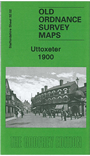
    This detailed map covers the Staffordshire town of Uttoxeter. The town centre is shown, with individual buildings neatly delineated, and coverage extends northward to The Heath and The Wharf, westward to Oldfields Hall, southward to Balance Hill. Features include railways and station, Ash Lea, cemetery, Leighton Iron Works, Market Place, St Mary's church, Cattle Market, Mount Pleasant, brewery, Manor House, The Hall, Carter Street, Cheese Factory, Park Place, Workhouse, Moorhouse Farm etc. On the reverse we also include a commercial directory for the town in 1912.


  • For a full list of maps of Staffordshire county, please go to the Staffordshire page or the Potteries page.
  • You can order maps direct from our On-line Mapshop. For other information and prices, and other areas, go to The Index Page.
  • Maps in the Godfrey Edition are taken from the 25 inch to the mile map and reduced to about 15 inches to the mile. For a full list of maps for England, return to the England page.
    Alan Godfrey Maps, Prospect Business Park, Leadgate, Consett, Co Durham, DH8 7PW / sales@alangodfreymaps.co.uk / 28 January 2018