
 Here are the details of maps for Longton (East):

Part of our extensive coverage of The Potteries, this detailed map covers the eastern part of Longton, together with Normacot and part of Meir. Coverage stretches from Cromartie Street eastward to Meir station, and from Anchor Road southward to Belgrave Road.
Features include North Staffordshire Railway with Millfield Junction, Normacot station, Meir station, stretch of Adderley Green & Bucknall Branch, Park Hall Colliery, Weston Sprink, Meir Hay, St James church, tramways, Court House, Queen's Pottery, other earthenware and pottery works, Church of the Resurrection, St Luke's church, Institute & Free Library, cottage hospital, Church of the Holy Evangelists, Normacot area, Christ Church, Holy Trinity church, Weston Coyney Brick Works etc. On the reverse we include directory extracts, including a Normacot, Lightwood & Meir Alphabetical List.
The map links up with sheets 18.07 Adderley Green to the north, 18.10Longton West to the west.
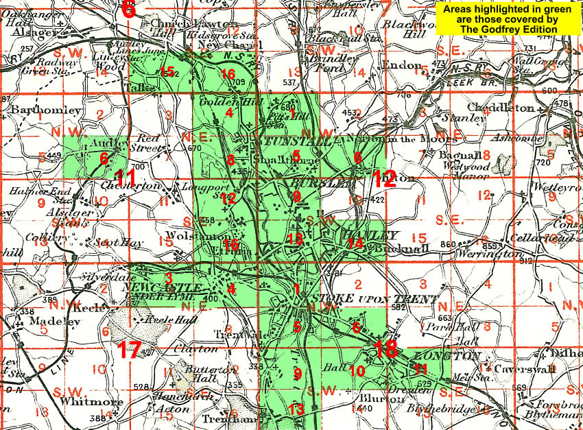
You might find this Index Map useful.