
 Here are the details of maps for Silverdale:

This detailed map covers most of the village of Silverdale, west of Newcastle-under-Lyme. Coverage stretches from Silverdale station eastward to Knutton Iron Works.
Features include St Luke's church, NSR railway with Silverdale station, old shafts, Wall Plantation, Rosemary Hill Tile Works, Milbank Colliery, Cemetery, Knutton Manor Colliery, Knutton Farm, Knutton Forge Junction, Newcastle Workhouse. On the reverse we include an 1893 directory of Silverdale.
The map links up with Staffordshire Sheets 17.02 Keele Northto the west, 11.15 Knutton to the north, and 17.04 Newcastle-u-Lyme to the east.
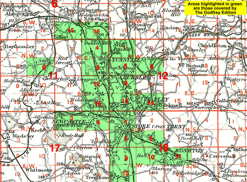
You might find this Index Map useful.