
 Here are the details of maps for Hanley (East):

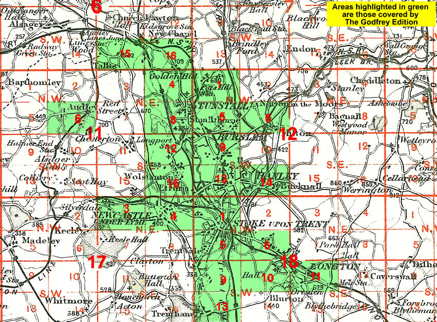
This detailed map covers the eastern side of Hanley, including Northwood and Wellington Wards, plus the village of Bucknall. Coverage extends from St John Street eastward to Townsend, and from Boulton Street southward to Botteslow Street.
Features include Eagle Pottery, Trent Sanitary Works, Ivy House Paper Mills, Northwood Colliery, Holy Trinity church, Clayholes Pit, NSR Biddulph Valley Line with Bucknall & Northwood station, Finney Gardens, Mossfield Colliery (disused), Bucknall, Brookhouse Green, infectious diseases hospital, old coal shafts, Bucknall Bridge, Jubilee Pit (disused), Caldon Canal, etc. On the reverse we include a Bucknall directory.
The map links up with Staffordshire Sheets 12.13 Hanley to the west, 18.02 Hanley SE to the south.
You might find this Index Map useful.