Old Ordnance Survey Maps of Staffordshire

  • These detailed maps normally cover an area of about one and a half miles by one mile. Each map includes an introduction.
  • They are available through our On-line Mapshop

  • Here are the details of maps for Milton (N):

  • Staffordshire Sheet 12.06 Milton (North) 1898 - published 2008; intro by Malcolm Nixon. ISBN.978-1-84784-102-5

    Continuing our coverage of The Potteries, this detailed map shows the area around and to the north of Milton, and east of Smallthorne. The Milton area includes St Philip & St James church, Market Street, station. Part of Baddeley Green is in the NE corner of the map. Part of Norton in the Moors, incl St Bartholomew's church, is near the top of the map. Ford Green, incl station, Ford Green Iron Works, mineral railways is at the west of the map. Part of the Caldon Canal is also shown. We include directories for Norton-in-the-Moors and Milton & Abbey on the reverse.

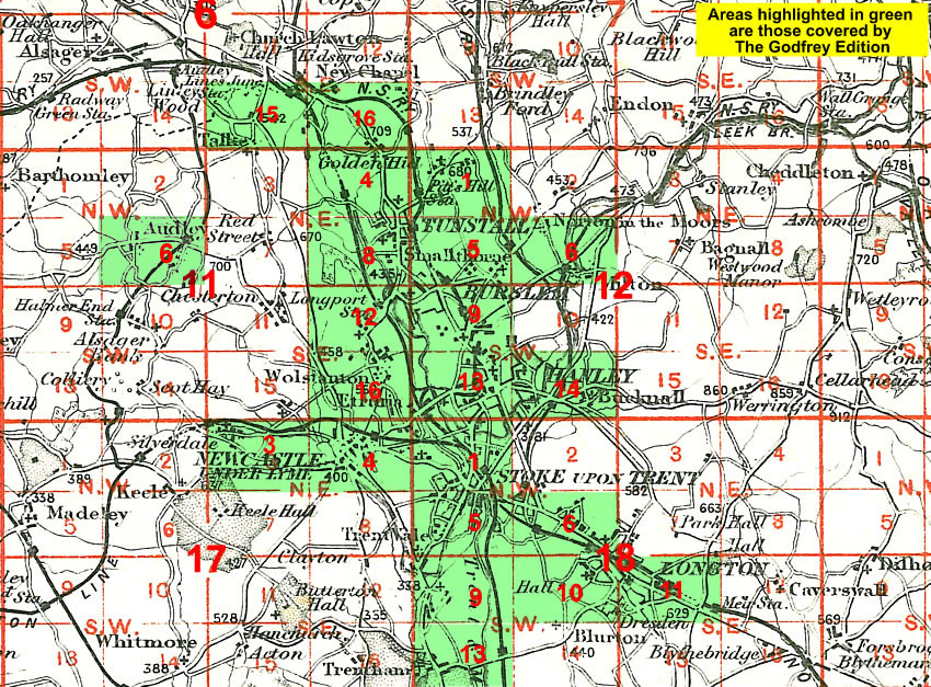
    The map links up with Staffordshire Sheet 12.05 Smallthorne to the west.

    You might find this Index Map useful.


  • For a full list of maps of Staffordshire, please go to the Staffordshire page or the Potteries page.
  • You can order maps direct from our On-line Mapshop. For other information and prices, and other areas, go to The Index Page.
  • Maps in the Godfrey Edition are taken from the 25 inch to the mile map and reduced to about 15 inches to the mile. For a full list of maps for England, return to the England page.
    Alan Godfrey Maps, Prospect Business Park, Leadgate, Consett, Co Durham, DH8 7PW / sales@alangodfreymaps.co.uk / 28 January 2018