Old Ordnance Survey Maps of Staffordshire

  • These detailed maps normally cover an area of about one and a half miles by one mile. Each map includes an introduction.
  • They are available through our On-line Mapshop

  • Here are the details of the map for north Tunstall:

  • Staffordshire Sheet 11.04 Tunstall (N) & Goldenhill 1898 - published 2011; intro by Malcolm Nixon. ISBN.978-1-84784-482-8

    This detailed map covers the northern part of Tunstall and coverage is then northward to Goldenhill.

    Features include Christ Church, Clanway Colliery, Royal Albert & Victoria Potteries, Summerbank Tileries, Newfield, Goldenhill Colliery, Hollywall Tileries, NSR railway with Chatterley station, Trent & Mersey Canal, Harecastle Tunnels, Line Houses, Ravenscliffe, Ashwood Colliery, Latebrook House, old coal shafts, mineral railway, NSR Newfields Branch etc. On the reverse we include an 1892 Goldenhill directory.

    The map links up with Staffordshire Sheets 6.16 Kidsgrove to the north, 11.03 Talke Pits to the west, 12.01 Great Chell to the east, 11.08 Tunstall to the south.

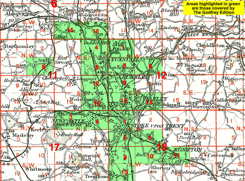
    You might find this Index Map useful.


  • For a full list of maps of Staffordshire, please go to the Staffordshire page or the Potteries page.
  • You can order maps direct from our On-line Mapshop. For other information and prices, and other areas, go to The Index Page.
  • Maps in the Godfrey Edition are taken from the 25 inch to the mile map and reduced to about 15 inches to the mile. For a full list of maps for England, return to the England page.
    Alan Godfrey Maps, Prospect Business Park, Leadgate, Consett, Co Durham, DH8 7PW / sales@alangodfreymaps.co.uk / 8 September 2020