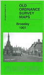
Shropshire Sheet 51.02 Broseley - published 2001; intro by Barrie Trinder. ISBN 978-1-84784-683-9 
This detailed map gives good coverage of Broseley, from All Saints church northward to Broseley Wood, and part of Benthall.
Features include All Saints church and Rectory, Broseley Tileries, Deept Pit, Stablehill Colliery (disused), Milburgh Tileries, Rock Tile Works, Botommcoal Colliery (disused),
Coneybury Farm, Broseley village with individual buildings neatly delineated, Broseley Hall, Hockleybank, Asleyfields Colliery (disused), Broseley Wood, chapels, pubs, Cockshot Mound, Benthall,
Benthall Potteries, The Deerleap, Old Leopard etc. We include a 1905 directory of Broseley on the reverse.
Follow this link for a complete list of our Shropshire or Telford maps.
You can order maps direct from our On-line Mapshop.
For other information and prices, and other areas, go to The Index Page.
Maps in the Godfrey Edition are taken from the 25 inch to the mile map and reduced to about 15 inches to the mile.
For a full list of maps for England, return to the England page.
The Godfrey Edition / sales@alangodfreymaps.co.uk / 30 January 2018

 Here are the details of maps for Broseley: