
Old Ordnance Survey Maps of Shropshire
These detailed maps normally cover an area of about one and a half miles by one mile. Each map includes an introduction.
They are available through our On-line Mapshop
 Here are the details of maps for Madeley South:
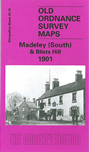
Shropshire Sheet 43.15 Madeley South & Blists Hill 1901 - published 2001; intro by Barrie Trinder. ISBN.978-1-84151-320-1 
This is one of two maps we publish for Madeley, this map covering the south of the town from High Street. Features include St Michael's Church, Madeley Market Station and Railway Line, Madeley Hall, Meadowpit Colliery, Blists Hill Iron Works, Suttonhill House, St Mary's Church and Jackfield Encaustic Tile Works. On the reverse of the map we include an extract from a commercial directory and a list of private residents.
This map links up with Shropshire Sheet 43.10 Coalbrookdale to the North-West, 43.11 Madeley Court to the North, 43.14 Ironbridge to the West and 51.02 Broseley to the South-West.
Follow this link for a complete list of our Shropshire or Telford maps.
You can order maps direct from our On-line Mapshop.
For other information and prices, and other areas, go to The Index Page.
Maps in the Godfrey Edition are taken from the 25 inch to the mile map and reduced to about 15 inches to the mile.
For a full list of maps for England, return to the England page.
The Godfrey Edition / sales@alangodfreymaps.co.uk / 30 January 2018