
Old Ordnance Survey Maps of Shropshire
These detailed maps normally cover an area of about one and a half miles by one mile. Each map includes an introduction.
They are available through our On-line Mapshop
 Here are the details of maps for Madeley Court:
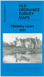
Shropshire Sheet 43.11 Madeley Court 1901 - published 1996; intro by Barrie Trinder. ISBN.978-0-85054-827-3 
This detailed map of Madeley Court covers Aqueduct, Halesfield Colliery, Cuckoo Oak and Tweedale. Features include Madeley Court Iron Works and Colliery, Madeley Salop Station and GWR Railway Line, Halesfield Colliery, St Mary's RC Chapel, Fox Buildings and Windmill Farm. On the reverse of the map we include a Railway Timetable for Wellington, Much Wenlock and Craven Arms line and an extract of a directory for private residents.
This map links up with Shropshire Sheet 43.06 Horsehay to the North-West, 43.07 Dawley Magna to the North, 43.10 Coalbrookdale to the West and 43.14 Ironbridge to the South-West.
Follow this link for a complete list of our Shropshire or Telford maps.
You can order maps direct from our On-line Mapshop.
For other information and prices, and other areas, go to The Index Page.
Maps in the Godfrey Edition are taken from the 25 inch to the mile map and reduced to about 15 inches to the mile.
For a full list of maps for England, return to the England page.
The Godfrey Edition / sales@alangodfreymaps.co.uk / 30 January 2018