
Old Ordnance Survey Maps of Shropshire
These detailed maps normally cover an area of about one and a half miles by one mile. Each map includes an introduction.
They are available through our On-line Mapshop
 Here are the details of maps for Dawley Magna:
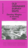
Shropshire Sheet 43.07 Dawley Magna & Stirchley 1901 - published 1991; intro by Barrie Trinder. ISBN.978-1-84151-319-4 
This detailed map of Dawley Magna & Stirchley covers the area from New Street and New Road through to Lower Brands in Stirchley. Features include Holy Trinity Church, Lord Inn Hotel, Dawley Castle (site of), Town Hall, Mission Church and White Hart Inn, Stirchley Iron Works, Grange Farm, St James's Church, Stirchley Hall Farm and the Railway Line & Station. On the reverse of the map we include an extract from a commercial directory and a list of private residents for Dawley.
This map links up with Shropshire Sheet 43.02 Lawley to the North-West, 43.03 Malins Lee to the North-West, 43.06 Horsehay to the West, 43.10 Coalbrookdale to the South-West and 43.11 Madeley Court to the South.
Follow this link for a complete list of our Shropshire or Telford maps.
You can order maps direct from our On-line Mapshop.
For other information and prices, and other areas, go to The Index Page.
Maps in the Godfrey Edition are taken from the 25 inch to the mile map and reduced to about 15 inches to the mile.
For a full list of maps for England, return to the England page.
The Godfrey Edition / sales@alangodfreymaps.co.uk / 30 January 2018