
 Here are the details of maps for Shrewsbury (East):

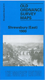
This map of Shrewsbury (East) covers a good part of the town, with the railway lines being a prominent feature on this map. Engine Sheds, The Loop Line and the Station all appear as does Midland Railway & Wagon Works. Other features include St Giles Church, Infirmary, English Bridge and Greenfriars Bridge, Oakley Manor and Holy Cross or the Abbey Church. Main Streets include Abbey Foregate, Belle Vue Road, Castlegates, Cannon Street and Wenlock Road. On the reverse of the map we include a street directory for Shrewsbury from Kelly's Directory.
This map links up with Shropshire Sheet 34.07 Shrewsbury (North) to the North and 34.10 Shrewsbury (West) to the West